

|
Philosophy
|
Projects
|
Experience
|
Clients
|
Resume
|
Resources
|

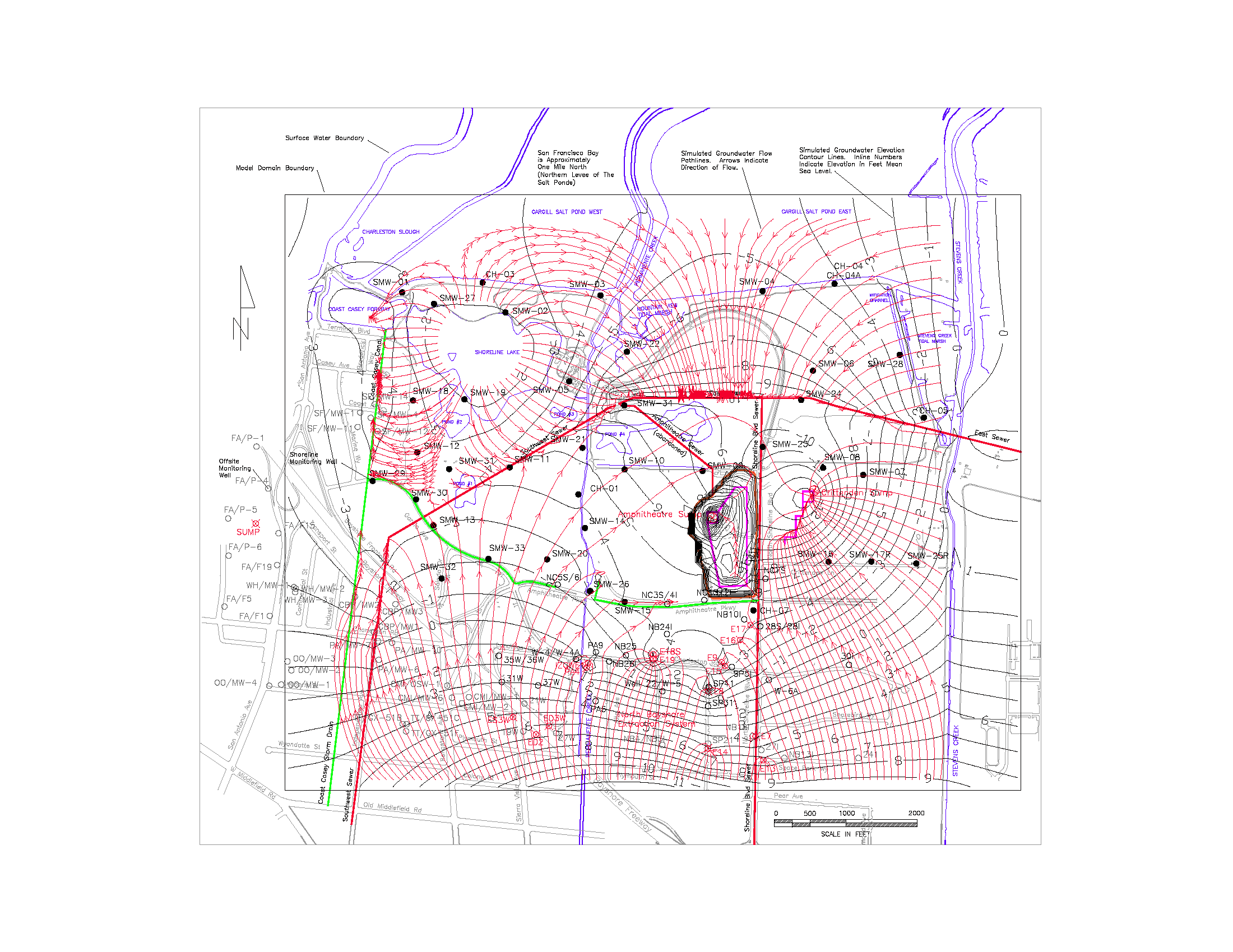
This map shows the results of a groundwater flow model that was used to evaluate the movement and quality of the shallow groundwater beneath Shoreline Park in Mountain View, a closed municipal solid waste landfill.
Zoom in, if necessary, to read the map annotation.
The curved red lines with arrows represent the path and direction of groundwater flow.
The long curved black lines with numbers indicate the groundwater elevation or head in feet relative to sea level.
Surface water features at this site have a strong effect on groundwater flow.
Groundwater flows radially outward from a water level "mound" beneath Shoreline Lake near the northwest corner of the map; the bed of the man-made lake leaks and is a source of groundwater recharge.
Groundwater flows toward, and is captured by, sanitary sewer pipelines, shown as straight red lines. These gravity-flow pipelines are below the water table and their bell-and-spigot joints typically leak.
Pumping wells, shown as red 'x'd circles near the south center of the map, also capture groundwater and are part of the North Bayshore Area environmental cleanup,
Shoreline Amphitheatre, the black rectangle of groundwater elevation contour lines near the center of the map, is surrounded by an underground clay slurry wall that restricts groundwater movement. Sump pumps inside the slurry wall lower groundwater levels to at least 30 feet below sea level, which is the elevation of the Amphitheatre stage.
Stevens Creek, the blue line near the east edge of the map is a losing stream that recharges groundwater -- groundwater flows away from the stream.
Mountain View Landfill Groundwater Flow Model
